

Nov 12, 2025 · 6 min read
Breaking News: Shocking Incident of Bridge Collapse Unfolds
Table of Contents The Aftermath: Details and Updates Implications for Infrastructure Development Community Response...
Monsoon Intensifies Across Regions Severe Weather Warnings Issued On July 20, 2025, Thailand’s Meteorological Department issued urgent warnings for heavy to very heavy rainfall in Chanthaburi, Trat, Ranong, and Phangnga provinces, driven by a strengthened southwest monsoon over the Andaman Sea and Gulf of Thailand. The forecast, effective through the coming days, highlights the risk

On July 20, 2025, Thailand’s Meteorological Department issued urgent warnings for heavy to very heavy rainfall in Chanthaburi, Trat, Ranong, and Phangnga provinces, driven by a strengthened southwest monsoon over the Andaman Sea and Gulf of Thailand. The forecast, effective through the coming days, highlights the risk of severe weather impacting Thailand’s eastern and southern regions. Authorities are urging residents to prepare for potential disruptions as monsoon conditions escalate.
The Meteorological Department cautioned residents in parts of Thailand’s central and northeastern regions to remain vigilant for localized downpours that could trigger flash flooding, especially in low-lying areas, near hillsides, or along watercourses. With rainfall expected to intensify, flood-prone zones face heightened risks. This alert aligns with Thailand’s ongoing efforts to enhance disaster preparedness, particularly during the rainy season, which affects 70% of the country annually.
Mariners in the Andaman Sea and Gulf of Thailand face hazardous conditions, with waves in the upper Andaman Sea projected to reach 2–4 meters and exceeding 4 meters in stormy areas. The lower Andaman Sea and upper Gulf of Thailand may see waves of 2–3 meters, with thunderstorms potentially pushing heights beyond 3 meters. Small boats are strongly advised to stay ashore, as rough seas pose significant risks to maritime safety until conditions stabilize.
Authorities are closely tracking Tropical Storm Wipha, located 560 kilometers east of Zhanjiang, China, in the upper South China Sea as of July 20, 2025. Moving west-northwest, the storm is expected to reach the Gulf of Tonkin and make landfall in northern Vietnam by July 21 or 22. While not directly hitting Thailand, Wipha’s presence is intensifying monsoon activity, contributing to the heavy rainfall forecast across the country’s southern and eastern provinces.
Thailand’s disaster management agencies are mobilizing to address the potential impacts of heavy rainfall and flooding. Local authorities are clearing drainage systems and reinforcing infrastructure in vulnerable areas to mitigate flood risks. The government’s proactive measures, including real-time weather monitoring through a national “war room,” aim to ensure swift responses to emerging threats, protecting communities and minimizing economic disruptions in affected regions.
Residents in at-risk areas are advised to monitor weather updates and prepare for possible evacuations, particularly in low-lying zones prone to flash floods and runoff. The Meteorological Department’s 24/7 hotline provides real-time information to keep communities informed. As Thailand anticipates 35 million tourists in 2025, these warnings also serve to safeguard visitors, ensuring the country remains a safe destination despite challenging weather conditions.
Table of Contents The Aftermath: Details and Updates Implications for Infrastructure Development Community Response...

Table of Contents Understanding the Relationship Between Climate Change and Natural Disasters Unraveling the Scienc...
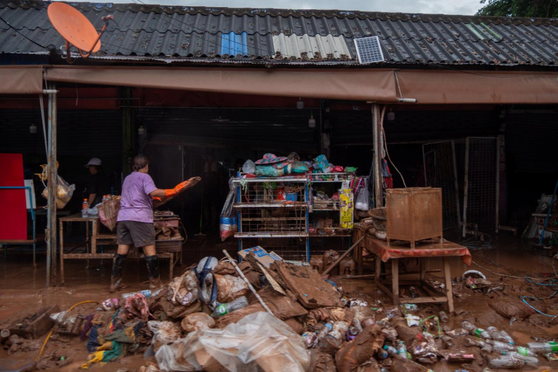
Devastating Floods Strike Nan Province Record Rainfall Overwhelms Communities Nan province faced unprecedented floo...

Rising River Levels Threaten Communities Chiang Rai Faces Severe Flooding On July 29, 2025, northern and northeaste...

Wildlife Bust at Suvarnabhumi Suspicious Luggage Sparks Investigation On July 25, 2025, a 53-year-old Japanese man,...

National Parks Support Military Operations Strategic Use of Border Areas Thailand’s Department of National Parks, W...