
Summer Storms Sweep Across Thailand
Severe Weather Conditions Forecast for April and May
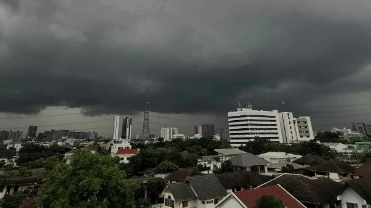
Thailand is preparing for a surge of summer storms and heavy rainfall, with the Meteorological Department forecasting widespread weather disruptions from April 26 to May 2. The northern and northeastern regions are expected to experience thunderstorms, gusty winds, hail, and isolated heavy rain, driven by a high-pressure system from China interacting with southeasterly and southwesterly winds amid intense heat. These conditions are likely to bring lightning strikes and unstable weather, especially as a westerly trough from Myanmar moves over the area between April 28 and May 1. Although the storms may ease slightly after May 1, hot weather and intermittent thunderstorms with strong winds are set to persist.
Regional Weather Impacts in Thailand
Thunderstorms, Hail, and Heat Across Provinces
A total of 56 provinces, including Bangkok, are under a summer storm warning. The upper part of Thailand will see a 40% chance of thunderstorms, strong winds, and occasional hail, particularly in provinces such as Chiang Mai, Lamphun, Lampang, Tak, Phrae, Nan, Uttaradit, Sukhothai, Kamphaeng Phet, Phichit, Phitsanulok, and Phetchabun. Temperatures are expected to range from 23 to 27°C at night to 37 to 41°C during the day. The northeast will face hot weather with thunderstorms in 30% of the area, while the central and eastern regions will also experience hot conditions with a 30–40% chance of storms and gusty winds. In Bangkok and surrounding areas, residents can expect hot weather with a 40% chance of thunderstorms, gusty winds, and some hail.
Heavy Rainfall and Rough Seas in Southern Thailand
Coastal Areas Warned of High Waves and Flood Risks
Southern Thailand, both on the east and west coasts, is bracing for heavy rainfall and rough seas. From April 26–28, southeasterly and southerly winds across the Gulf of Thailand and westerly winds over the Andaman Sea will bring significant rain, with wave heights in the Andaman Sea expected to reach around one metre and rising to over two metres during thunderstorms. The southern region (east coast) will have a 40% chance of thunderstorms and heavy rain in areas such as Surat Thani, Nakhon Si Thammarat, Phatthalung, Songkhla, Pattani, Yala, and Narathiwat. On the west coast, provinces like Phang Nga, Phuket, Krabi, Trang, and Satun will see a 60% chance of thunderstorms and some heavy rain, with sea waves rising to over two metres during storms.
Public Advisory and Safety Measures
Precautions Urged for Residents and Farmers
The Meteorological Department is urging the public, especially in upper Thailand, to take precautions during the stormy period. Residents should avoid open areas, large trees, weak structures, and billboards due to the heightened risk of flash floods, runoff, and lightning strikes. Farmers are advised to reinforce crops, protect livestock, and prepare for potential agricultural damage. In the South, people are advised to watch for heavy rainfall and water accumulation, particularly from April 26–27, and to monitor weather updates closely. All are encouraged to take necessary health precautions amid fluctuating weather conditions.
Outlook for the Coming Weeks
Persistent Heat and Intermittent Storms Expected
While the intensity of storms may decrease after May 1, Thailand will continue to experience hot weather with occasional thunderstorms and strong winds due to ongoing wind convergence. The Meteorological Department advises everyone to remain vigilant, stay updated on weather forecasts, and follow safety guidelines to minimize risks during this period of variable and potentially severe weather.